Chill out! Freezing Rain, Snow, and Sleet
/It seems like there's almost always the threat of inclement weather on the horizon during this time of year around Greenwich. Sometimes we get a light dusting of snow, sometimes heaping piles. Freezing rain can really gum things up, and then we sometimes see sleet, another frigid foe of winter. The exact mix of precipitation we (and the rest of the East Coast) end up with depends on a lot of factors. Very specific conditions are required for snow, sleet, or freezing rain to occur and these conditions can change quickly. It can be hard to predict weather, but understanding the underlying science makes it easier.

Snow
Snow is the winter weather pattern with the most charisma. Snowflakes falling at night make for a lovely scene and the delicate and unique patterns of the flakes are a delight. Snowflakes first begin to form high in the atmosphere. The base of each snowflake is a tiny particle of dust or pollen. When the air is below freezing, water vapor molecules will bind to the particle and freeze. As more and more molecules bind to the group they begin to form the intricate patterns of a snowflake.

A snowflake always has six sides or arms.
The molecular structure of water causes snowflakes to always be hexagonal, having six sides or six arms. The growing weight of a forming snowflake causes it to start descending from the clouds and drifting towards ground. As the snowflake descends it gathers more and more water molecules and the snowflake crystal grows.
The shape of a snowflake is determined by temperature and humidity levels. Even the smallest of variations can produce different patterns. Since each snowflake drifts on a different path to the ground, every snowflake encounters its own set of conditions. The infinite variety of temperature and humidity histories for snowflakes is what produces the infinite variety of structures in those flakes.
However, even if snow forms in the upper reaches of the atmosphere, it will not reach the ground as snow unless temperatures are below freezing all the way down. If a snowflake encounters warm air as it falls then it will melt and its crystal structure will be lost.
Sleet
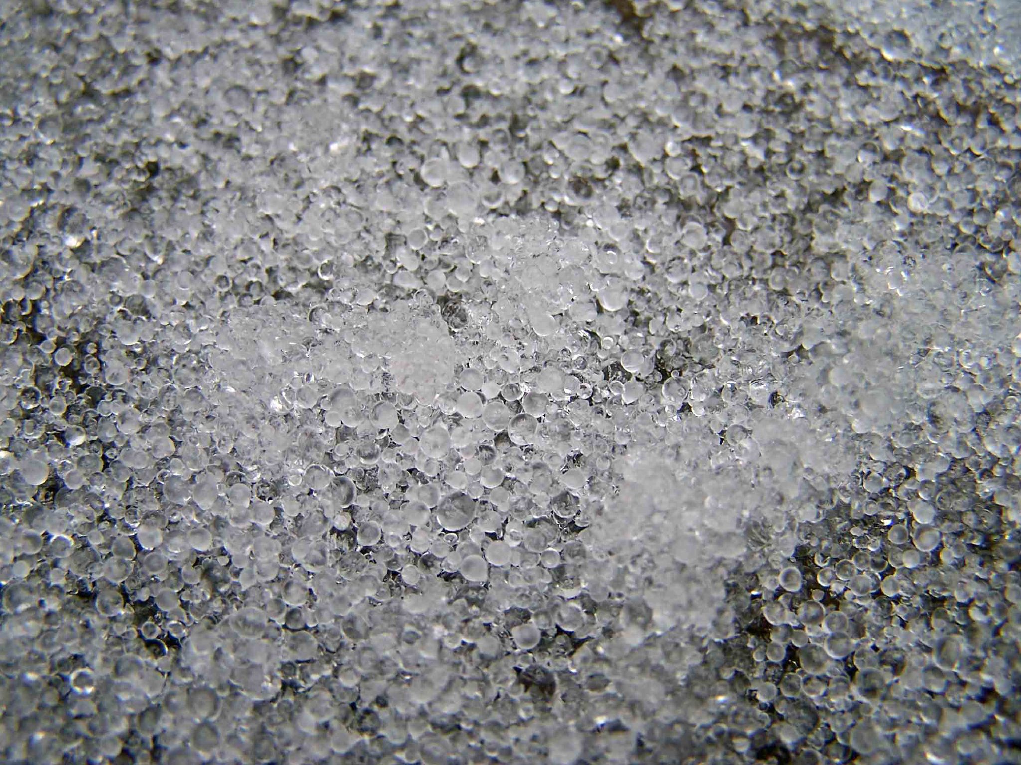
Courtesy of Mike Epp
Sleet forms when rain or melted snow encounters a cold air layer that freezes it before it reaches the ground. This can occur when warm air flows over denser cold air, forming zones of air with alternating temperature. Unlike the beautiful structure of snow, sleet falls as small ice pellets that usually bounce on impact with the ground.
Freezing Rain

Courtesy of Laslovarga
A lot of branches break under the stress of freezing rain.
Freezing rain forms in a similar manner to sleet but is far more destructive and disruptive. Like sleet, snow falls, encounters a warm layer of air, and melts. For freezing rain to develop there needs to be freezing air around the ground, but not a thick enough layer for the rain to freeze into sleet. The cold air supercools the falling water droplets which then freeze on contact with whatever they strike first. Roads, power lines, and trees can become coated in thick sheets of ice and are sometimes quite hazardous.
A Summer Ice: Hail
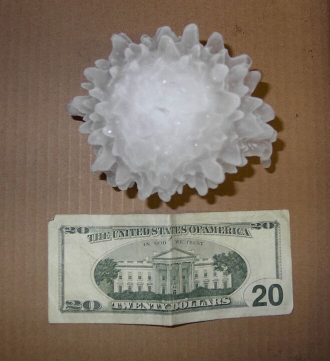
This 5.5 inch hailstone fell in Harper, Kansas on May 14, 2004.
While hail is often confused with sleet, it is actually rather different. Hail generally occurs in spring and summer rather than the winter months. Hail forms in turbulent thunderstorm clouds. When supercooled water droplets come in contact with small particles of dust or pollen, water freezes around the particles. These small ice pellets are then caught in the updraft of the storm and flung upwards through the cloud.
As they are tossed skyward, moisture continues to freeze to the growing hailstones. They grow larger and larger until they become too heavy to be supported by the updraft. At this point the hailstone finally falls to earth.
Hailstones can spend a long time on the updraft, usually at least 30 minutes before they are overcome by their weight. Thunderstorms are often more than 10 km high, giving plenty of space for the hail to advance. The speed of hail growth depends on a variety of factors, but the largest hailstones can be up to 15 cm (6 inches) in diameter. Large-sized hailstones can damage both properties and people, and some countries have even launched efforts to chemically alter clouds to reduce hailstorm severity.
- Kate Dzikiewicz, Paul Griswold Howes Fellow